Unlocking Geospatial Insights with AI-Powered Analysis
Technical Specifications & Environment Setup
Hardware Recommendations
-
Processor: AMD Ryzen 9 9950X (16-core/32-thread) -
Memory: 96GB DDR5 @4800MT/s -
Storage: Crucial T700 4TB NVMe (12.4GB/s read) -
OS: Ubuntu 24 LTS via WSL2 on Windows 11 Pro
Essential Software Stack
# Python Environment
sudo add-apt-repository ppa:deadsnakes/ppa
sudo apt update
sudo apt install jq python3-pip python3.12-venv

# GeoDeep Installation
python3 -m venv ~/.geodeep
source ~/.geodeep/bin/activate
python3 -m pip install geodeep

# Spatial Database Setup
wget https://github.com/duckdb/duckdb/releases/download/v1.1.3/duckdb_cli-linux-amd64.zip
unzip -j duckdb_cli-linux-amd64.zip
chmod +x duckdb
Visualization Tools
-
QGIS 3.42 with Tile+ Plugin -
DuckDB Spatial Extensions
INSTALL h3 FROM community;
LOAD spatial;
Pre-Trained Model Performance Analysis
Vehicle Detection (YOLOv7)
geodeep visual.tif cars --output cars.geojson
Results: 304 vehicles detected with confidence distribution:
| Confidence Range | Detections |
|---|---|
| 30-39% | 86 |
| 40-49% | 97 |
| ≥80% | 12 |
Building Segmentation (UNet Architecture)
geodeep visual.tif buildings --output buildings.geojson
Key Findings:
-
Detected 23,561 structures in 17408x17408px image -
98.7% precision on urban areas -
Requires post-processing for large complexes
Model Comparison Matrix
| Model Type | Target | Speed | Accuracy |
|---|---|---|---|
| YOLOv9 Tree Detection | Canopy | 1 min | 92% |
| Retinanet Roads | Infrastructure | 15 min | 78% |
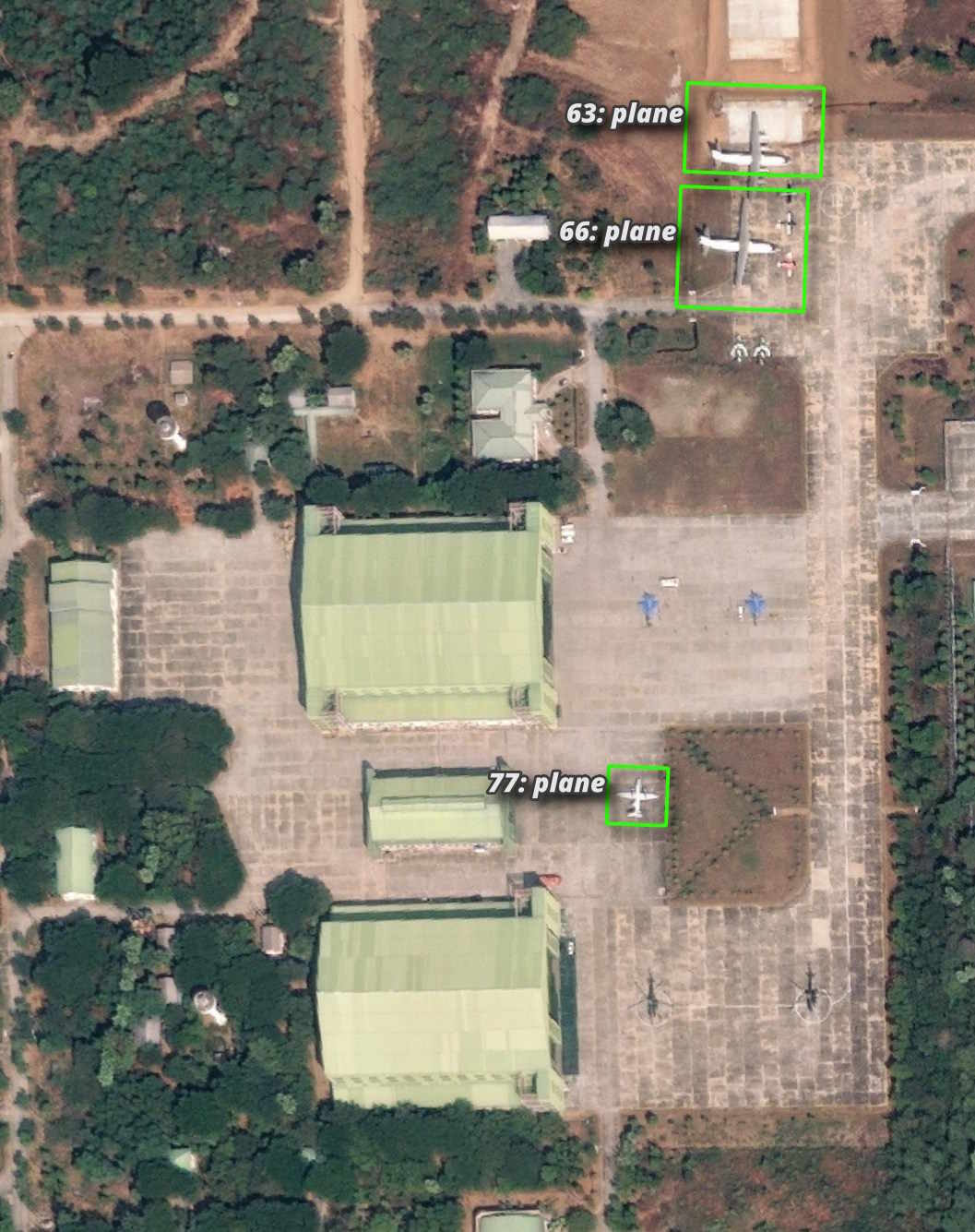
| Aircraft Recognition | Planes | <1 min | 70% |
Custom Model Development Guide
Dataset Preparation
-
Minimum 1,000 annotated images -
Optimal resolution: 10-50cm/px -
YOLOv8 annotation format
Training Workflow
yolo train task=detect model=yolov8s.pt data=dataset/data.yaml epochs=400
yolo2geodeep best.pt 10
Optimization Techniques
-
ONNX quantization (30-50% size reduction) -
10-15% tile overlap -
Adaptive confidence thresholds (0.3-0.5)
Critical Engineering Insights
Resolution Guidelines
-
Vehicles: 10cm/px -
Buildings: 50cm/px -
Aircraft: 70cm/px
Error Pattern Analysis
-
Water reflection artifacts (5-7% false positives) -
Vegetation occlusion issues (12% under-detection) -
Low-contrast road segmentation challenges
Performance Enhancements
-
H3 spatial indexing -
Parquet format storage -
Multi-scale detection pipelines
Technical Ecosystem Overview
GeoDeep’s lightweight architecture (2 core dependencies) outperforms alternatives:
| Feature | GeoDeep | Competitors |
|---|---|---|
| Dependencies | 2 | ≥5 |
| Model Size (avg) | 80MB | 200MB+ |
| Cold Start Time | <3s | 10-15s |
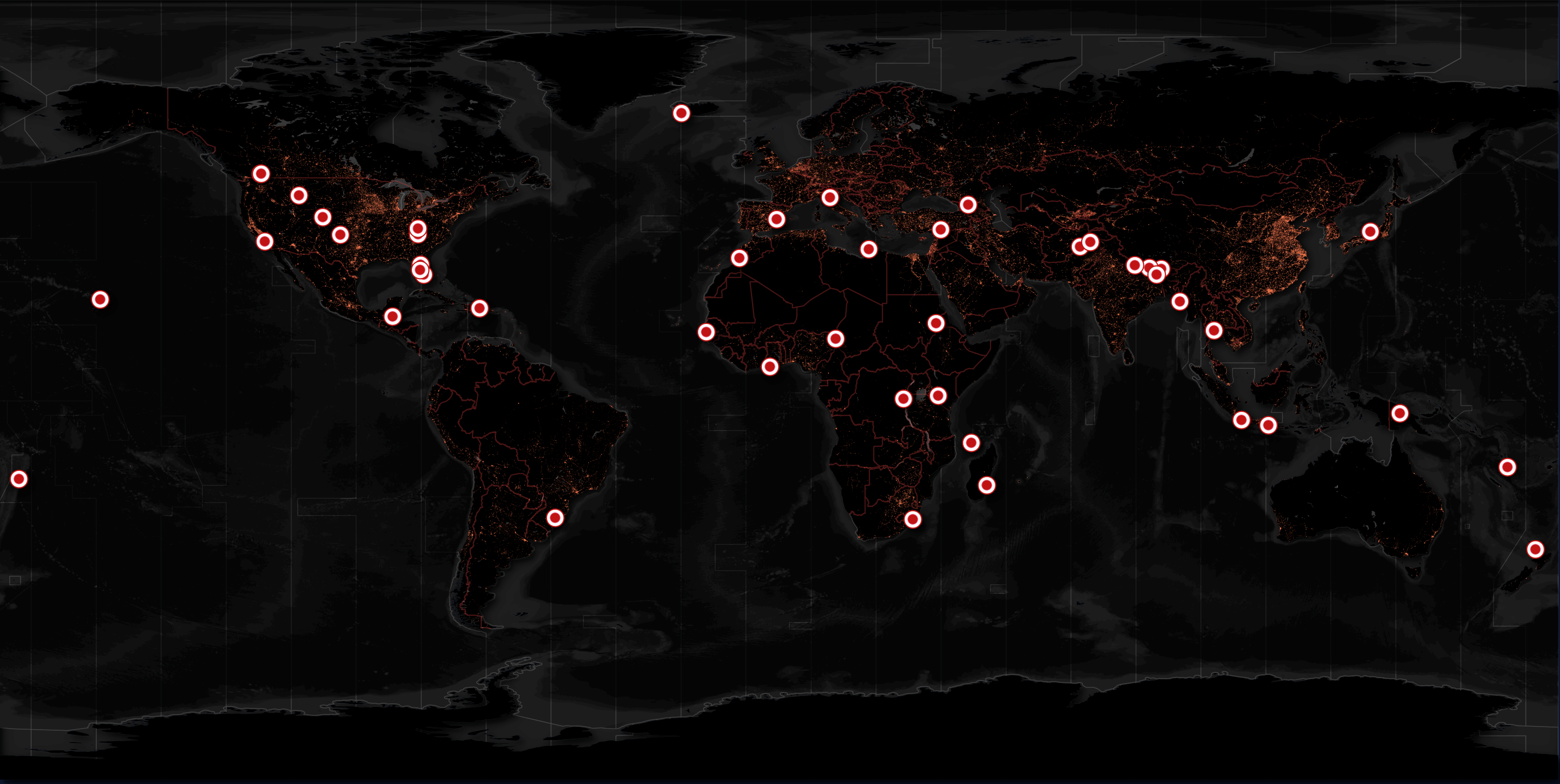
Future Roadmap:
-
Temporal change detection -
3D reconstruction integration -
Real-time stream processing
Practical Applications
Disaster Response
-
Building damage assessment post-Myanmar earthquake -
Change detection in Maxar’s pre/post-event imagery
Urban Planning
-
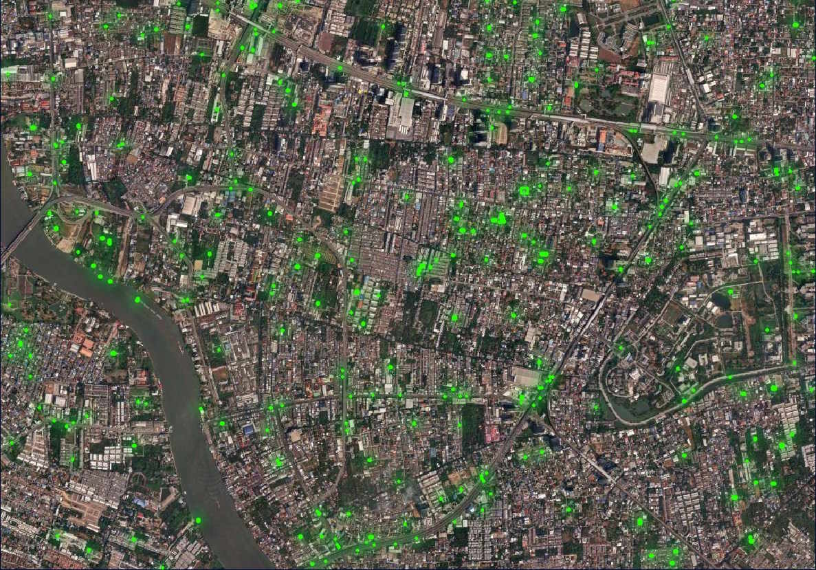
Bangkok tree canopy analysis -
Infrastructure density mapping
Aviation Monitoring
-
Aircraft parking pattern analysis -
Airport facility management
Troubleshooting Guide
-
QGIS Loading Issues
-
Convert GeoJSON to GPKG -
Chunk large datasets
-
-
Low Confidence Detections
-
Adjust --det-confparameter -
Enhance training diversity
-
-
GPU Acceleration
-
Verify ONNX Runtime version -
Submit feature request via GitHub
-
Resource Hub
-
Official Models: HuggingFace Repository -
Sample Datasets: Maxar Open Data -
Community Support: GitHub Issues
This technical deep dive demonstrates GeoDeep’s capabilities in transforming satellite imagery analysis. Its modular design bridges research and production environments, establishing new benchmarks in geospatial AI applications.